Shengavit District (Verkhniy Shinkovit)
Shengavit (Շենգավիթ վարչական շրջան, Šengavit' varčakan šrĵan), is one of the 12 districts of Yerevan, the capital of Armenia, located at the southwestern part of the city. It has common borders with the districts of Malatia-Sebastia, Kentron, Erebuni and Nubarashen. Ararat Province forms the southern borders of the district.
With an area of 48.5 km² (18.16% of Yerevan city area), Shengavit is the 2nd-largest district of Yerevan in terms of area. It is unofficially divided into smaller neighborhoods such as Lower Shengavit, Upper Shengavit, Lower Charbakh, Upper Charbakh, Noragavit and Aeratsia. Garegin Nzhdeh Square along with the metro station form the core of the district. The main streets of the district are Garegin Nzhdeh Street, Shirak Street, Artashesyan Street, Bagratunyats Street and Arshakunyats Avenue.
The joint civil and military Erebuni Airport is located in the district. The district is also home to the Yerevan Thermal Power Plant.
Shengavit is one of the highly industrialized districts of Yerevan with many large plants and factories. However, the district is considered to be home to middle and low-income residents of Yerevan.
The district has many parks with the most notable ones are Komitas Pantheon and park, Artur Karapetyan park, Movses Gorgisyan park and Shoghakat park.
As of 2016, the population of the district is around 139,100.
Map - Shengavit District (Verkhniy Shinkovit)
Map
Country - Armenia
 |
 |
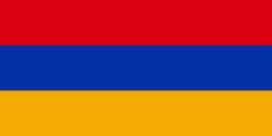
| Flag of Armenia | |
Armenia is a unitary, multi-party, democratic nation-state with an ancient cultural heritage. The first Armenian state of Urartu was established in 860 BC, and by the 6th century BC it was replaced by the Satrapy of Armenia. The Kingdom of Armenia reached its height under Tigranes the Great in the 1st century BC and in the year 301 became the first state in the world to adopt Christianity as its official religion. The ancient Armenian kingdom was split between the Byzantine and Sasanian Empires around the early 5th century. Under the Bagratuni dynasty, the Bagratid Kingdom of Armenia was restored in the 9th century. Declining due to the wars against the Byzantines, the kingdom fell in 1045 and Armenia was soon after invaded by the Seljuk Turks. An Armenian principality and later a kingdom Cilician Armenia was located on the coast of the Mediterranean Sea between the 11th and 14th centuries.
Currency / Language
| ISO | Currency | Symbol | Significant figures |
|---|---|---|---|
| AMD | Armenian dram | Ö | 2 |
| ISO | Language |
|---|---|
| HY | Armenian language |


